Poster Session 6 · Friday, December 5, 2025 4:30 PM → 7:30 PM
#1608 Spotlight
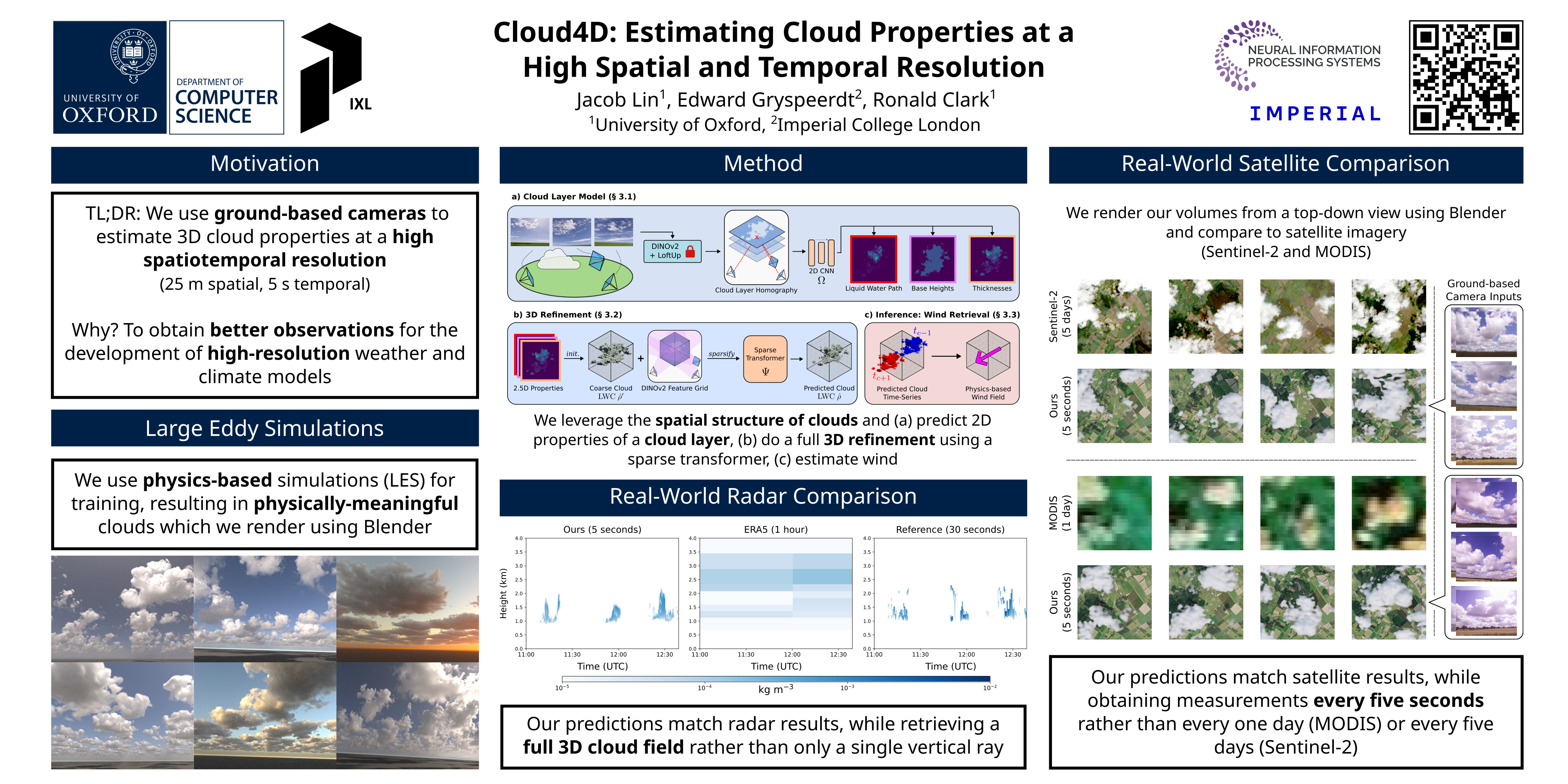
Cloud4D: Estimating Cloud Properties at a High Spatial and Temporal Resolution
Abstract
There has been great progress in improving numerical weather prediction and climate models using machine learning. However, most global models act at a kilometer-scale, making it challenging to model individual clouds and factors such as extreme precipitation, wind gusts, turbulence, and surface irradiance. Therefore, there is a need to move towards higher-resolution models, which in turn require high-resolution real-world observations that current instruments struggle to obtain.
We present Cloud4D, the first learning-based framework that reconstructs a physically consistent, four-dimensional cloud state using only synchronized ground-based cameras. Leveraging a homography-guided 2D-to-3D transformer, Cloud4D infers the full 3D distribution of liquid water content at 25 m spatial and 5 s temporal resolution.
By tracking the 3D liquid water content retrievals over time, Cloud4D additionally estimates horizontal wind vectors. Across a two-month deployment comprising six skyward cameras, our system delivers an order-of-magnitude improvement in space-time resolution relative to state-of-the-art satellite measurements, while retaining single-digit relative error () against collocated radar measurements.