Poster Session 2 · Wednesday, December 3, 2025 4:30 PM → 7:30 PM
#2609
Reconciling Geospatial Prediction and Retrieval via Sparse Representations
Abstract
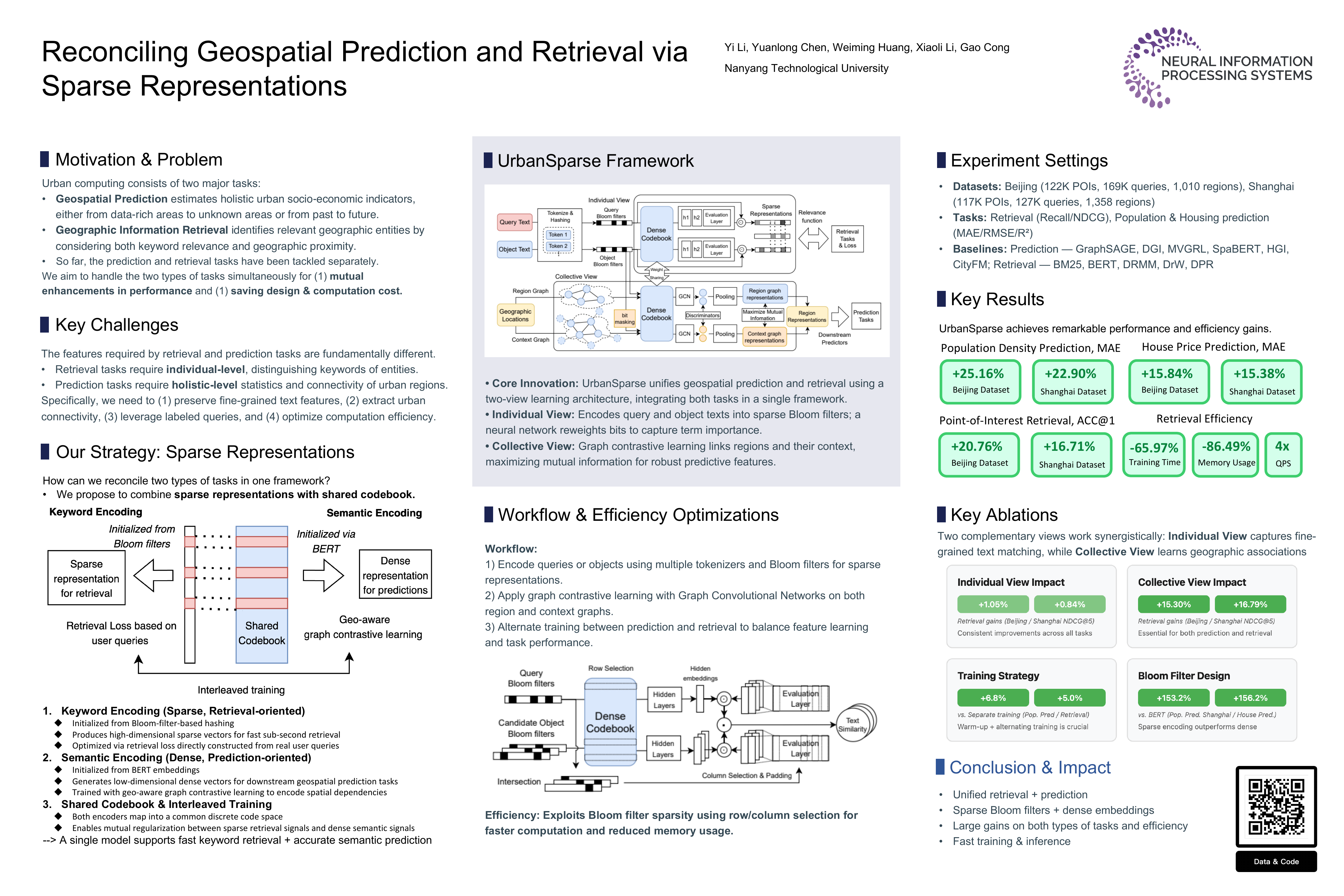
Urban computing harnesses big data to decode complex urban dynamics and revolutionize location-based services. Traditional approaches have treated geospatial prediction tasks (e.g., estimating socio-economic indicators) and retrieval tasks (e.g., querying geographic objects) as isolated challenges, necessitating separate models with distinct training objectives. This fragmentation imposes significant computational burdens and limits cross-task synergy, despite advances in representation learning and multi-task foundation models.
We present UrbanSparse, a pioneering framework that unifies geospatial prediction and retrieval through a novel sparse-dense representation architecture. By synergistically combining these tasks, UrbanSparse eliminates redundant systems while amplifying their mutual strengths.
Our approach introduces two innovations:
- Bloom filter-based sparse encodings that compress high-sparsity geographic queries and fine-grained text terms for retrieval effectiveness, and
- a dense semantic codebook that captures granular urban features to boost prediction accuracy.
A two-view contrastive learning mechanism further bridges urban objects, regions, and contexts.
Experiments on real-world datasets demonstrate 25.16% gains in prediction accuracy and 20.76% improvements in retrieval precision over state-of-the-art baselines, alongside 65.97% faster training. These advantages position UrbanSparse as a scalable solution for large urban datasets. To our knowledge, this is the first unified framework bridging geospatial prediction and retrieval, opening new frontiers in data-driven urban intelligence.